

Reclassify Features in HSM
Summary
Assigns a fixed suitability score (0–100) to every cell of a habitat suitability model that falls inside your polygon features — the standard fix for influences the base habitat factors could not capture. Land cover is usually several years old, so an HSM can happily depict a new housing development as optimal habitat, or recently restored land as unsuitable. The remedy: digitize the unmapped influence as polygons and reassign those cells a score reflecting current reality — a new subdivision or fenced right-of-way scored 0, a wildlife-friendly easement scored higher. Cells outside the polygons keep their original scores. A modernized port of the CorridorDesigner Reclassify Features tool; no Spatial Analyst needed.
What happens to each cell
A cell whose center falls inside any input polygon gets the new score (the same cell-center rule Esri's extraction tools use); every other cell keeps its value, and NoData stays NoData — the tool never invents data where the model had none, even under a polygon. An active map selection on the polygon layer is honored. The run messages report how many cells were reassigned, and warn if none fell inside the features (wrong layer, wrong extent, or an over-tight selection). True-curve polygons — geodatabase buffer circles and arcs — are densified automatically before rasterizing, so they burn as full shapes.
A tour of the dialog
The example runs the tool the optimistic way round. The black bear model from the Corridor Design Tutorial scores three blocks of ground in and around the Santa Rita block as a mix of everything from optimal to non-habitat, because that is what the land cover, elevation, topography and roads add up to there. Now suppose word reaches us from someone who knows the ground that those three blocks are in fact excellent bear habitat: a recent survey, a restoration project the land cover layer predates, a private holding managed for wildlife. Rather than rebuild the model, we digitize the three areas as polygons and hand them to this tool with a new score of 95.
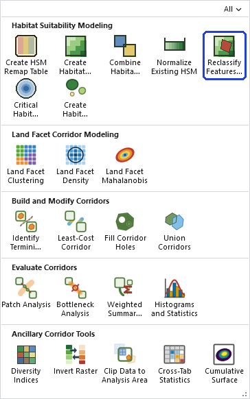
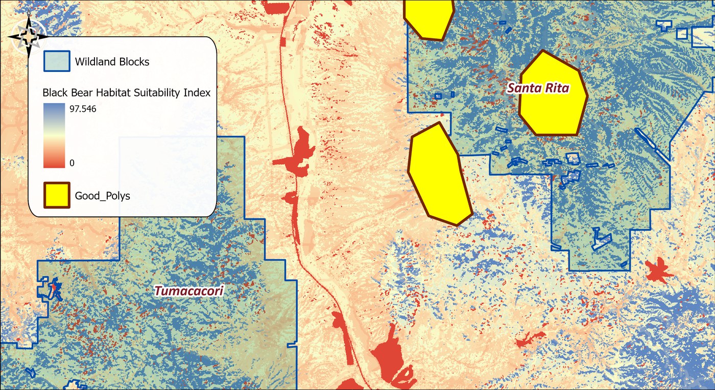
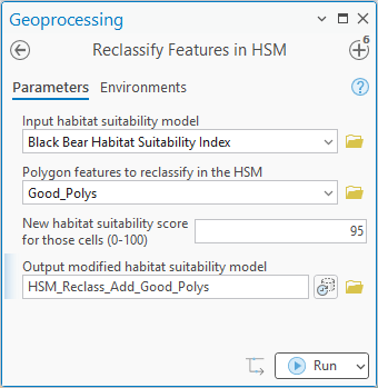
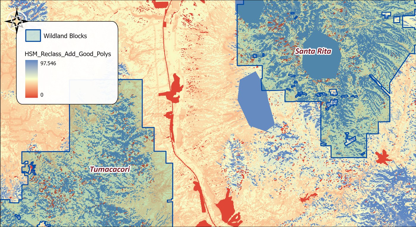
- Input habitat suitability model. The 0–100 surface to modify, picked from the map or browsed to. It is never changed; the tool writes a new raster.
- Polygon features to reclassify in the HSM. The digitized influence. If the layer has a selection, only the selected polygons are used.
- New habitat suitability score for those cells. The 0–100 value assigned to every cell whose center falls inside a polygon: 95 here, 0 for ground that has been lost.
- Output modified habitat suitability model. The name and location of the result. A name inside a geodatabase gives a geodatabase raster; a name in a folder gives a GeoTIFF.
Notice what the tool does not do. It does not blend the new score into its surroundings, and it does not ask whether 95 is reasonable: the polygons and the score are the modeler's claim about the world, and the tool applies it exactly. That is the right behavior for a correction, but it puts the burden on the evidence behind the polygons.
The tool holds the whole raster in memory at once, so the memory it needs grows with the number of cells. On most rasters that is no concern. On a very large one the tool may need more memory than your computer has free, and then one of two things happens: Windows starts using the disk as overflow memory and the tool slows to a crawl, or the tool stops with an out-of-memory error. There is no fixed limit; it depends on how much memory your computer has free. If a raster is too large, clip it to the area you need first.
ModelBuilder
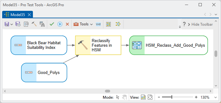
Parameters
| Label | Explanation | Data type |
|---|---|---|
| Input habitat suitability modelRequired · in_hsm | The 0–100 surface to modify. | Raster Layer |
| Polygon features to reclassifyRequired · in_features | The digitized influence; an active selection is honored. | Feature Layer |
| New habitat suitability scoreRequired · new_score | The 0–100 score assigned inside the polygons. | Double |
| Output modified HSMRequired · out_raster | The updated surface. | Raster Dataset |
Python
import arcpy
arcpy.ImportToolbox(r"C:\path\to\JennessEnterprisesTools.pyt")  # your install path
arcpy.jenness.ReclassifyFeaturesInHSM(
    in_hsm=r"D:\corr.gdb\blackbear_hsm",
    in_features="New_Subdivision_Footprint",
    new_score=0,
    out_raster=r"D:\corr.gdb\blackbear_hsm_dev")
Recommended citation
Credits and references
By Jeff Jenness, Jenness Enterprises (www.jennessent.com), ported from the CorridorDesigner tools by Jenness, Majka and Beier.
- Beier, P., D. Majka, and J. Jenness. 2007, revised 2026. Designing wildlife corridors with ArcGIS: ArcGIS Pro edition. Workshop book, revised by J. Jenness for the Corridor Designer Tools of the Wildlife and Forestry Tools add-in. Available at: CorridorDesigner_WorkshopBook_2026_ArcGISPro.pdf (5 MB)
- Beier, P., D. Majka, and J. Jenness. 2007. Designing wildlife corridors with ArcGIS. Workshop book, Northern Arizona University. Available at: corridordesign.org (archived copy at the Internet Archive)
Licensing information
Works at every ArcGIS Pro license level (Basic, Standard, Advanced). No extension licenses are required.
Related tools and pages
- Create Habitat Suitability Model — builds the surface this tool corrects.
- Critical Habitat Feature — the other HSM modifier, for distance-dependent resources.