

Union Corridors
Summary
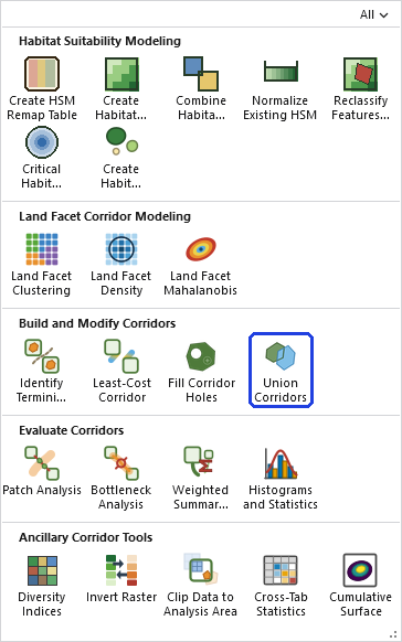
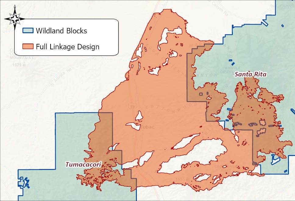
Combines every input polygon feature class into one seamless shape — unions them, then dissolves the result into a single multipart polygon. This is the tool that turns single-species (or single-facet) corridors into the preliminary linkage design: as the workshop book puts it, “the union of single-species corridors constitutes a preliminary linkage design… the most obvious way to fulfill our goal of ‘no species left behind.’” Per-input attributes are deliberately not preserved — the combined shape answers “is this ground part of any corridor?”, not which one.
Select before you run — the key workflow
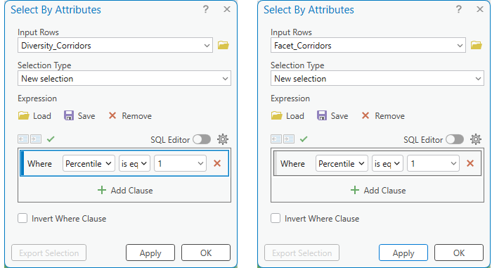
A corridor feature class typically holds many percentile-width bands as separate features (the Percentile field). To union just the 5% bands across several species, select Percentile = 5 on each input's map layer before running. Each input's selection is honored independently — one feature class can be filtered to a subset while another in the same run is used in full, and an input with no selection contributes everything.
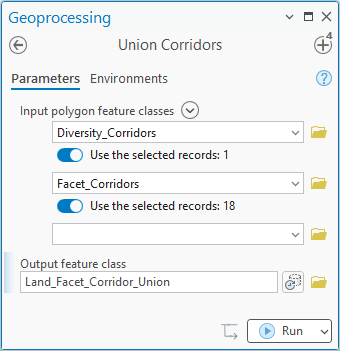
The Land Facet Tutorial is the pattern in action: eighteen facet corridors in one feature class and the interspersion corridor in another, every percentile slice present in both, and only the 1% slices wanted. Select By Attributes on each layer, then the tool.
Cross-analysis awareness
Every input's linkage record (when it carries one) is read and compared by analysis id — the id shared by every dataset descended from the same clustering run or corridor lineage. More than one distinct id means the union combines genuinely different analyses. For this tool that is usually exactly the point — different species' corridors into one linkage — so it warns for awareness rather than refusing.
A tour of the dialog
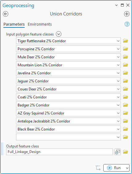
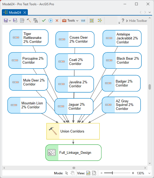
The example below is the twelve-species linkage from the Corridor Design Tutorial: each species' 2% corridor as one input, the preliminary linkage design as the output.
ModelBuilder
Parameters
| Label | Explanation | Data type |
|---|---|---|
| Input polygon feature classesRequired · in_features | The corridors (or any polygons) to combine; each map layer's active selection is honored independently. | Feature Layer (multiple) |
| Output feature classRequired · out_features | The single dissolved multipart polygon. | Feature Class |
Python
import arcpy
arcpy.ImportToolbox(r"C:\path\to\JennessEnterprisesTools.pyt")  # your install path
arcpy.jenness.UnionCorridors(
    in_features=r"D:\corr.gdb\bear_corridor;D:\corr.gdb\deer_corridor;D:\corr.gdb\coati_corridor",
    out_features=r"D:\corr.gdb\Preliminary_Linkage")
Recommended citation
Credits and references
By Jeff Jenness, Jenness Enterprises (www.jennessent.com), ported from the CorridorDesigner tools by Jenness, Majka and Beier.
- Beier, P., D. Majka, and J. Jenness. 2007, revised 2026. Designing wildlife corridors with ArcGIS: ArcGIS Pro edition. Workshop book, revised by J. Jenness for the Corridor Designer Tools of the Wildlife and Forestry Tools add-in. Available at: CorridorDesigner_WorkshopBook_2026_ArcGISPro.pdf (5 MB)
- Beier, P., D. Majka, and J. Jenness. 2007. Designing wildlife corridors with ArcGIS. Workshop book, Northern Arizona University. Available at: corridordesign.org (archived copy at the Internet Archive)
Licensing information
Works at every ArcGIS Pro license level (Basic, Standard, Advanced). No extension licenses are required.
Related tools and pages
- Least-Cost Corridor and Fill Corridor Holes — upstream of the union.
- Cumulative Surface — the counting alternative: how many corridors cover each cell, rather than one merged shape.
- About Corridor Design — from preliminary union to finished linkage design.