

Combine Habitat Factors
Summary
Combines habitat factor rasters that are already scored on the 0–100 suitability scale into one habitat suitability model — the second half of Create Habitat Suitability Model, split out on its own, skipping the remap step. Weighted geometric mean (recommended: a 0 in any factor zeroes the cell — Liebig's Law of the Minimum) or weighted additive mean, weights summing to 100. A modernized port of the CorridorDesigner Combine Habitat Factors tool; no Spatial Analyst needed.
When to reach for it: experimentation
Building a habitat model is iterative. Weights are expert judgment, not measured quantities — the workshop book is frank that weighting is one of the weakest parts of these models — so you may want to try land cover at 60, then at 70, or set geometric against additive, several times over. Run Create Habitat Suitability Model once with Save reclassified habitat factors checked, then re-combine the saved factors here as many times as you like: only the cheap combine step repeats, never the reclassification. It equally accepts 0–100 factors scored by any other means — a Normalize Existing HSM output, or a surface you reclassified yourself.
A tour of the dialog
The example picks up where the
Corridor Design
Tutorial leaves off. The black bear model was built with
land cover 75, elevation 10, topographic position 10 and
distance from roads 5, with Save reclassified habitat
factors checked, so the four _r rasters are
sitting in the geodatabase already scored. Here we ask what
happens if land cover matters a little less than the expert
said and roads a little more: land cover drops by 5, to 70,
and distance from roads rises by 5, to 10, with elevation and
topographic position left at 10 each. The weights still sum to
100, the method stays geometric mean, and the run takes
seconds because nothing has to be reclassified.
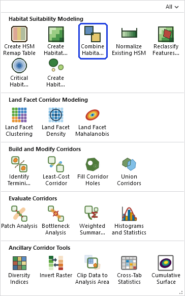
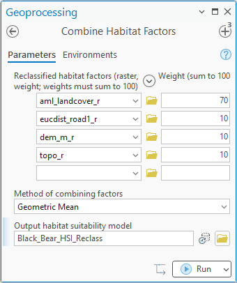
- Reclassified habitat factors. One row per factor: the 0–100 raster, picked from the map or browsed to, and its weight. Rows are added by filling in the empty one at the bottom. The weights must sum to exactly 100; the tool checks and stops with a message if they do not.
- Method of combining factors. Geometric Mean or Additive Mean, the same two choices as Create Habitat Suitability Model, and the same reasons for preferring the geometric mean.
- Output habitat suitability model. The name and location of the result. A name inside a geodatabase gives a geodatabase raster; a name in a folder gives a GeoTIFF.
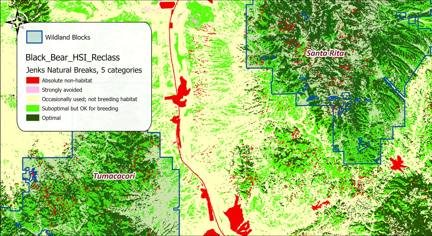
Put the two models side by side, or subtract one from the other with the Raster Calculator, and the question of whether the change matters answers itself. That is the whole point of the tool: the expensive step happens once, and the argument about weights can go on as long as it needs to.
The tool holds all of its raster data in memory at once, so the memory it needs grows with the number of cells. On most rasters that is no concern. On a very large one the tool may need more memory than your computer has free, and then one of two things happens: Windows starts using the disk as overflow memory and the tool slows to a crawl, or the tool stops with an out-of-memory error. There is no fixed limit; it depends on how much memory your computer has free. If your rasters are too large, clip them to the area you need first.
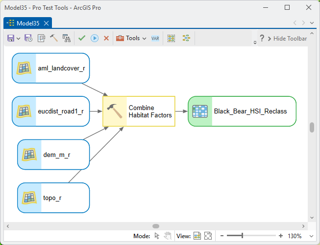
ModelBuilder
Parameters
| Label | Explanation | Data type |
|---|---|---|
| Reclassified habitat factorsRequired · factors | One row per factor: the 0–100 raster and its weight; weights must sum to 100. | Value Table |
| Method of combining factorsRequired · method | Weighted geometric mean (recommended) or weighted additive mean. | String |
| Output habitat suitability modelRequired · out_raster | The combined 0–100 surface. | Raster Dataset |
Python
import arcpy
arcpy.ImportToolbox(r"C:\path\to\JennessEnterprisesTools.pyt")  # your install path
arcpy.jenness.CombineHabitatFactors(
    factors="lndcvr_r 50;elev_r 20;topo_r 15;dstroad_r 15",
    method="Weighted geometric mean",
    out_raster=r"D:\corr.gdb\blackbear_hsm_w2")
Recommended citation
Credits and references
By Jeff Jenness, Jenness Enterprises (www.jennessent.com), ported from the CorridorDesigner tools by Jenness, Majka and Beier.
- Beier, P., D. Majka, and J. Jenness. 2007, revised 2026. Designing wildlife corridors with ArcGIS: ArcGIS Pro edition. Workshop book, revised by J. Jenness for the Corridor Designer Tools of the Wildlife and Forestry Tools add-in. Available at: CorridorDesigner_WorkshopBook_2026_ArcGISPro.pdf (5 MB)
- Beier, P., D. Majka, and J. Jenness. 2007. Designing wildlife corridors with ArcGIS. Workshop book, Northern Arizona University. Available at: corridordesign.org (archived copy at the Internet Archive)
Licensing information
Works at every ArcGIS Pro license level (Basic, Standard, Advanced). No extension licenses are required.
Related tools and pages
- Create Habitat Suitability Model — run it once with saved factors, then iterate here.
- Normalize Existing HSM — another source of 0–100 factors.