
|
|
|
|
|
|
|
|
|
|
|
|
![]()
![]()
|
Last Modified: Revision 1.0.116, March 14, 2011 |
|
|
|
|
|
Downloads |
On-Line Manuals (requires Adobe Acrobat Reader) |
|
Raster
Extractor for ArcGIS 9.x (6.2 MB) Raster Extractor for ArcGIS 10.x (6.3 MB) |
Manual in Letter (8.5 x 11) page size |
Topics: Raster Catalog Raster Dataset Mosaic Combine Clip
Author: Jeff Jenness
Wildlife Biologist, GIS Analyst
Jenness Enterprises
3020 N. Schevene Blvd.
Flagstaff, AZ, 86004 USA
(928) 607-4638
Description: The Raster Extractor tool allows you to extract any number of rasters from an existing raster catalog and load them as individual rasters in your map, thereby allowing you to analyze them in ways that the Raster Catalog does not allow. The tool also gives you the option to mosaic all the rasters into a single raster dataset, modify the cell size and trim the final raster to the visible extent.
For example, suppose you have a large raster catalog containing multiple elevation tiles and you wish to extract just those tiles that cover some region of interest. This example uses a global elevation dataset comprised of over 22,000 1°x1° tiles from the ASTER Global Digital Elevation Model (see http://asterweb.jpl.nasa.gov/gdem.asp).
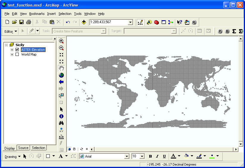
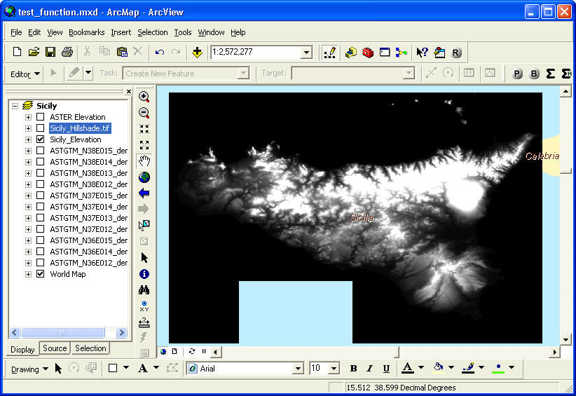
If we wanted to analyze the elevation in Sicily, Italy, we would simply zoom to the island in the map.
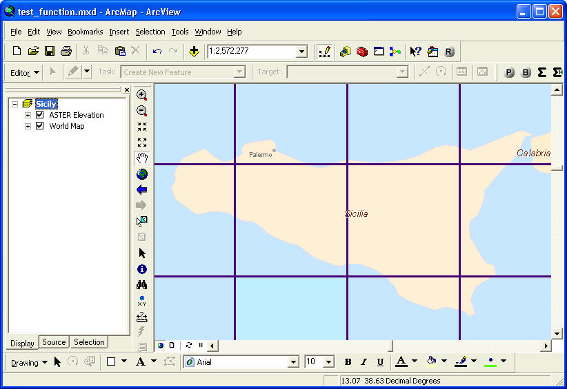
As seen in the illustration above, the island of Sicily covers portions of several elevation tiles. If we want to analyze elevation over the entire island, we could use this tool to extract the relevant tiles and optionally combine them into a single elevation dataset.
Individual Elevation Tiles Extracted from Raster Catalog as Separate Datasets
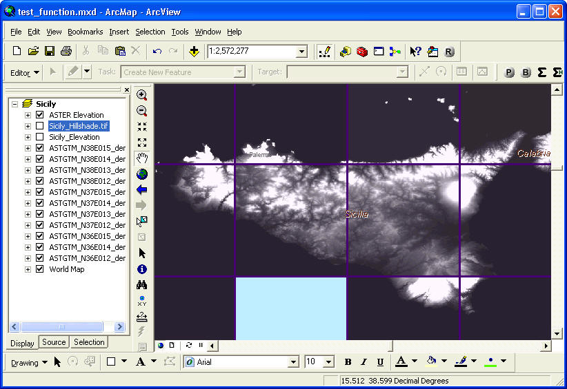
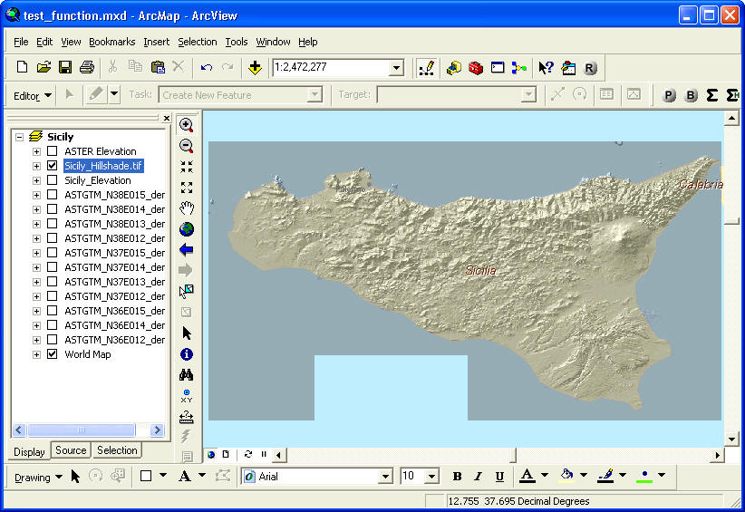
Elevation Tiles combined and clipped to map extent.
Elevation converted to Hillshade, just for illustration purposes. This tool does not include a Hillshade function.
For those who are interested, the extension DEM Surface Tools offers functions to calculate hillshades on latitude/longitude DEMs.
This extension includes 2 tools:
1) Tool to extract raster datasets from a raster catalog, with options to combine and clip those rasters to the current display extent.
2) Tool to quickly select all raster catalog datasets that intersect the selected features from any feature class.
Recommended Citation Format: For those who wish to cite this extension, the author recommends something similar to:
Jenness, J. 2010. Raster Extractor for ArcGIS (RasterExtractor.exe). Jenness Enterprises. Available at: http://www.jennessent.com/arcgis/RasterExtractor.htm
Please let me know if you cite this extension in a publication. I will update the citation list to include any publications that I am told about.
Requires: ArcGIS 9.1 or better, at any license level. This extension has not been tested with ArcGIS 9.0, and I am sure it will not work with ArcGIS 8.x. This tool has only been tested on Windows 2000 and XP.
Important: This extension does not require Spatial Analyst or 3D Analyst. It will work just fine without any add-on extensions.
![]()
For detailed installation and operation instructions, view the on-line PDF version of
Raster Extractor Manual
![]()
![]()
Revisions
Version 1.0
| Build 1.0.107 (January 1, 2010): Initial Release | |
| January 15, 2010: Version 1.0.109: Fixed “Division by Zero” error. | |
| October 25, 2010: Version 1.0.112: Added installation function for ArcGIS 10.0. | |
| November 16, 2010: Version 1.0.115: Rewrote functions that are incompatible with ArcGIS 10. | |
| November 17, 2010: Version 1.0.116: Fixed a bug related to raster catalogs in personal geodatabases, which would trigger a “Type Mismatch” error at line 252 of the function “ExtractRasterDatasets.” | |
| March 14, 2011: Added additional ArcGIS 10 registration instructions to manual to handle Windows 7/Vista and Windows 32-bit/64-bit issues. |
![]()
Enjoy! Please contact the author if you have problems or find bugs.
Jeff Jenness jeffj@jennessent.com
Jenness Enterprises http://www.jennessent.com
3020 N. Schevene Blvd.
Flagstaff, AZ 86004
USA
![]()
Please visit Jenness Enterprises ArcGIS Tools site for more ArcGIS tools and other software by the author. We also offer GIS consultation services for both ArcGIS and ArcView 3.x to help you meet your specific data analysis and application development needs.
![]()