These are documents authored or coauthored by Jeff Jenness, some of
which are available for viewing on the web or for free downloading.

Beyer, H.L., J.S. Jenness, and S. Cushman. 2010.
Components of spatial information management in wildlife ecology:
software for statistical and modeling analysis. Chapter 14 in Spatial
Complexity, Informatics, and Wildlife Conservation, Editors Sam Cushman
and Falk Huettmann. Springer.
Dickson, B., J. Jenness and P. Beier. 2005.
Influence of vegetation topography, and roads on cougar movement in
southern California. Journal of Wildlife Management
69(1):264–276.
Dooley, J., J. Jenness, and J. Aguilar-Manjarrez. 2003. The African Water Resource Database. in Conf. Proc.; 21st
International Cartographic Conference ICC 2003. International
Cartographic Association (ICA). Durban, South Africa. p. 2154 - 2165.
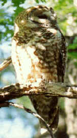
Ganey, J. L., S. Ackers, P. Fonken, J. Jenness, C. Kessler, K.
Nodal, P. Shaklee, and E. Swarthout. 23 November 1999. A Pilot Study on Monitoring Populations of Mexican Spotted Owls in Arizona and New Mexico:
Progress Report. USDA Forest Service, Rocky Mountain
Research Station 2500 South Pine Knoll Drive, Flagstaff, AZ 86001.
Ganey, J. L., W. M. Block, J. S. Jenness, and R. A. Wilson. 1997.
Comparative habitat use of sympatric Mexican spotted and great horned
owls. Journal
of Wildlife Research. 2(2): 115-123
Ganey, J. L., W. M. Block, J. S. Jenness, and R. A. Wilson. 1999.
Mexican spotted owl home
range and habitat use in pine-oak forest: implications for forest
management. Forest Science. 45(1):127-135.
Ganey, J. L., W. M. Block, J. K. Dwyer, B. E. Strohmeyer, and J. S.
Jenness.
1998.
Dispersal
movements and survival rates of juvenile Mexican Spotted Owls. Wilson Bulletin 110(2): 206-217.
Gertjan de Graaf, Felix Marttin, José Aguilar-Manjarrez, and Jeff
Jenness. 2003.
Geographic
Information Systems in Fisheries Management and Planning: Technical
manual. FAO FISHERIES TECHNICAL PAPER 449, Food and Agriculture
Organization of the United Nations, Viale delle Terme di Caracalla,
00100 Rome, Italy
Hall, M. K., C. S. Walker, J. A. Weeks, L. P. Kendall,
and J. S. Jenness. Exploring Ocean Environments: GIS Investigations for
the Earth Sciences, ArcGIS® Edition (with CD-ROM), 2nd Edition. Brooks
Cole. 176p.
Hall, M. K., C. S. Walker, J. A. Weeks, L. P. Kendall,
and J. S. Jenness. Exploring Tropical Cyclones: GIS Investigations for
the Earth Sciences, ArcGIS® Edition, 2nd Edition. Brooks Cole. 176p.
Hall, M. K., C. S. Walker, J. A. Weeks, L. P. Kendall,
and J. S. Jenness. Exploring Water Resources: GIS Investigations for the
Earth Sciences, ArcGIS® Edition, 2nd Edition. Brooks Cole. 176p.
Hall, M. K., C. S. Walker, J. A. Weeks, L. P. Kendall,
and J. S. Jenness. Exploring the Dynamic Earth: GIS Investigations for
the Earth Sciences, ArcGIS® Edition, 2nd Edition. Brooks Cole. 160p.
Jenness, J. S. May, 2000.
The
Effects of Fire on Mexican Spotted Owls in Arizona and New Mexico.
Master's Thesis, Northern Arizona University. Flagstaff, Arizona, 86011,
USA.
Jenness, J. S. 2004. Calculating landscape surface area from digital elevation
models. Wildlife Society Bulletin.
32(3):829-839
Jenness, J. S. February 12, 2007.
Some Thoughts on
Analyzing Topographic Habitat Characteristics. Originally
published in the June 2005 issue of
Remotely Wild
(newsletter of the GIS, Remote Sensing, and Telemetry Working Group of
The Wildlife Society). This document gets added to whenever I get
the time.
Jenness, J.S. 2009. Analyzing raster elevation datasets.
Earth Imaging Journal. September / October 2009, 6(5):32-33.
Jenness, J. S., P. Beier and J. L. Ganey. 2004.
Associations between forest fire and Mexican spotted owls. Forest Science 50(6). p. 765 - 772
Jenness, J., and J.J. Wynne. 2005. Cohen’s Kappa and
classification table metrics 2.0: an ArcView 3.x extension for accuracy
assessment of spatially explicit models: U.S. Geological Survey
Open-File Report OF 2005-1363. U.S. Geological Survey, Southwest
Biological Science Center, Flagstaff, AZ. Available at
http://pubs.er.usgs.gov/usgspubs/ofr/ofr20051363
Jenness, J.; Dooley, J.; Aguilar-Manjarrez, J.; Riva, C.
2007. African Water Resource Database. GIS-based tools for inland
aquatic resource management. 1. Concepts and application case studies
CIFA Technical Paper. No. 33, Part 1. Rome, FAO.167p. (also available
at:
http://www.fao.org/docrep/010/a1170e/a1170e00.htm).
Jenness, J.; Dooley, J.; Aguilar-Manjarrez, J.; Riva, C.
2007. African Water Resource Database. GIS-based tools for inland
aquatic resource management. 2. Technical manual and workbook. CIFA
Technical Paper. No. 33, Part 2. Rome, FAO. 308 p. (also available at
http://www.fao.org/docrep/010/a0907e/a0907e00.htm).
Tagil, S. and J.S. Jenness. 2008.
GIS-based automated landform classification and topographic, landcover
and geologic attributes of landforms around the Yazoren Polje, Turkey.
Journal of Applied Sciences. 8(6):910-921
If interested, please feel free to review my
Resume and Vitae.
Adobe PDF files require the free Adobe Acrobat reader:

Scientists are treacherous allies on committees, for
they are apt to change their minds in response to arguments.
Cecil Maurice Bowra (1898-1971)

E-mail
Jeff Jenness