Mexican Spotted Owls and Fire, Appendix B: Individual Territory Summaries and Maps |
||||||||||||||||||||||||||||
Burned Territories
|
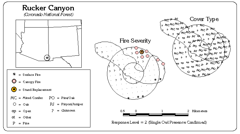
The Rucker Canyon territory (MT #0501009) is located in the Chiricahua Mountains of the Coronado National Forest, west of Portal, AZ. The original territory size is 188 hectares (464 acres) and the addition of our 1-km radius circle increased our survey area to 378 ha (935 ac). The original territory ranges in elevation from 2,009 - 2,475 meters (6,591 - 8,120 feet) and has a fairly equal distribution of north-, east-, south- and west-facing slopes. The average slope over the territory is 32.3 . The Rucker Canyon territory was paired with the unburned Dobson Peak territory located approximately 3 kilometers to the south. Along with the Mormon Canyon and Rattlesnake Peak territories, the Rucker Canyon territory was burned by the Rattlesnake fire in 1995. We had 56 habitat survey points within our original territory boundary and 75% of these showed no evidence of recent fire. 4% showed only evidence of ground fire, 4% burned to some degree (but not completely) into the canopy and 0% showed complete stand-replacement burn. 18% of the survey points were inaccessible or otherwise not surveyed. Prior to the fire, 5% of the territory had a Pine cover type, 11% had a mixture of Pine and Oak, and 30% had a Mixed-Conifer cover type. 36% was classified as "Other" and 18% was unknown.
|
|||||||||||||||||||||||||||